Little Manitou Lake

Search this page
Little Manitou Lake is one of Saskatchewan’s most unique lakes. Nicknamed the “Dead Sea of Canada”, the lake has an exceptionally high mineral content with salinity about half that of the Dead Sea. This allows swimmers to float effortlessly in its waters, making it a destination unlike any other in the province.
The lake is located just 5 km north of Watrous and about 126 km east of Saskatoon, with access via Highway 365.
Attractions and Activities
- Resort Village of Manitou Beach - Situated on the south shore, this village is home to the Manitou Springs Resort & Mineral Spa, where visitors can enjoy the same mineral waters indoors year-round.
- Danceland - A historic dance hall famous for its original horsehair dance floor, still hosting events and live music today.
- Camp Easter Seal - The province’s only barrier-free camp, offering accessible programs and facilities for children and adults with disabilities.
- Manitou District Regional Park - Spread across three areas around the village, the park features a campground, golf course, sandy beach, and day-use areas.
- Events - The community hosts numerous events each year, including the popular Chainsaw Carving Festival.
Nature
Because of its high salt concentration, no fish live in Little Manitou Lake, but the water itself is the main attraction. Its unique buoyancy and healing reputation have drawn people to its shores for generations.
Is this not the Little Manitou Lake you are looking for? There are 2 Little Manitou Lakes in Saskatchewan.
Current Conditions
Weather
Quick weather at a glance. Tap for full details.
Satellite
Recent imagery around Little Manitou Lake.
Nearby Water Stations
Quick links to nearby gauge stations and latest readings.
Details
| Fishing Zone: | Southern Zone |
| User Rating: | 5.0 / 5.0 |
| Favourited: | 1 times |
| Photos: | 38 photos of Little Manitou Lake |
| RM: | Viscount No. 341, Usborne No. 310, Morris No. 312 |
| Communities: | Resort Village of Manitou Beach |
| Parks: | Manitou District Regional Park |
| Location: | 51.737893623591, -105.52761260128 |
| Shore Length: | 43km |
| Surface Area: | 3,758 acres |
| Outflows: | None |
Recent Activity
Campground fully open. Partial fire ban in place for the RM but not at the regional park. Not that windy in the campground; is worse right by the water. Mike’s bar is open - Yahoo!
Comments, experiences, questions, and answers
Add CommentRating from
Comment from
Question from
Reply from
Directions to Little Manitou Lake
Get directions to the lake: here
Note: this just takes you to the closest road to the centre of the lake, and may not be the best route to get to the lake.
For directions directly to a service/amenity at the lake click on one of the listings in Services & Amenities
How it got its name
Manitou comes from the Algonquian word meaning "mysterious being," or Great Spirit.
Events
I don't know of any events at this time.
Manitou District Regional Park
This Regional Park has camping, a golf course, and day use facilities, public beach, changerooms, down by the lake
Contact
Phone: Campground office: (306) 946-2588 (during camping season) Golf Course: (306) 946-2861
Website: https://saskregionalparks.ca/park/manitou-district/
Mailing Address: Box 1193 Watrous, SK S0K 4T0
Amenities
- Barrier Free Areas (Wheelchair Accessible)
- Camping (Electricity and Water)
- Camping Seasonal
- Driving Range
- Golf Course Club House (Food Service)
- Group Camping
- Hiking Trails
- Pet Friendly
- Potable Water
- Restaurant
- Showers
- Wildlife Viewing
- Camp Kitchen / Picnic Shelter
- Camping (Electricity
- Water
- Sewer)
- Cell Phone Service
- Fire Wood
- Golf Course Club House (Licensed)
- Group Camping with Hall and/or Kitchen
- Internet and/or Wifi Service
- Picnic Tables
- Quiet Time Enforced
- Security
- Skiing - Cross Country
- Camping (Electrical Sites)
- Camping (Non-Electrical)
- Concession
- Golf Course 9 Hole Grass Greens
- Golf Course Pro Shop
- Hall and/or Shelter Rental
- Licensed Establishment
- Playground
- Racquet Sports (Tennis
- Badminton)
- Sewer Dump Station
- Washrooms (Modern / Running Water)
Fishing at Little Manitou Lake
No fish in the lake due to the high salt content.
Little Manitou Lake is in the southern fishing zone.
What fish are in Little Manitou Lake
We don't know of any fish species that can be found in Little Manitou Lake. Please let me know if you do!
Additional Restrictions:
Fishing Season
Fishing season on Little Manitou Lake is from May 5, 2026 to March 31, 2027.
Disclaimer
Although we try our best to provide correct and updated information for every lake in Saskatchewan, all information on this site is provided to use at your own risk. Please reference the Saskatchewan Anglers Guide for more information.
Fishing Attractions/Services at Little Manitou Lake
Boating at Little Manitou Lake
I don't have any boat launches, or marinas reported for this lake. Let me know if I'm missing one!
Camping at Little Manitou Lake
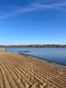
Beaches at Little Manitou Lake
There is 1 beach at Little Manitou Lake.
Photos of Little Manitou Lake
Little Manitou Lake
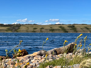
The colours!
Little Manitou Lake
Sky
Little Manitou Lake
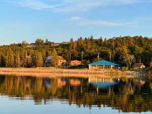
Camp Easter Seal
Little Manitou Lake
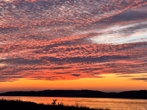
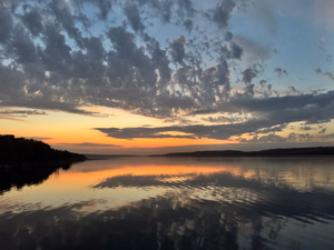
Dusk
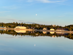
Little Manitou Lake
Little Manitou Lake
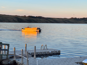
Little Manitou Lake
Pontoon boat near Camp Easter Seal
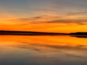
Little Manitou Lake
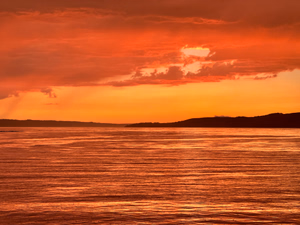
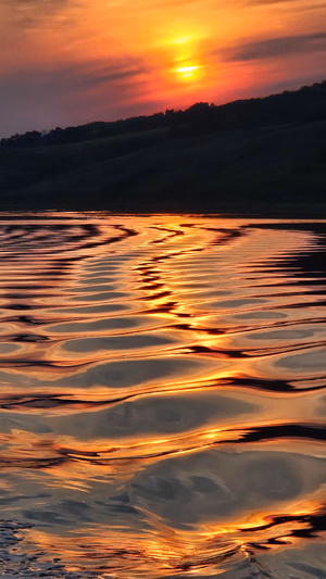
Sunset
Little Manitou Lake
Danceland
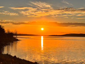
Little Manitou Lake
Sunset
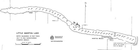
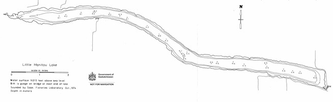
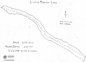
Bathymetric Maps
Bathymetric (Depth) Charts for Little Manitou Lake
Nearby Services & Amenities
Communities near Little Manitou Lake
There are 2 communities at Little Manitou Lake.
Nearby Lakes


Products for Little Manitou Lake
References
References
Other References
- Little Manitou Lake (Wikipedia)
- Little Manitou Lake (Canadian Geographical Names Database)
- https://www.manitoubeach.ca/
- Resort Village of Manitou Beach (Canadian Geographical Names Database)
- https://www.danceland.ca/
- https://manitougolf.com/
- https://camp.saskabilities.ca/
- https://manitousprings.ca/
- Watrous (Canadian Geographical Names Database)
Data Sources & References
- Weather data: OpenWeather - https://openweathermap.org/
- Satellite imagery: © European Union, Copernicus Programme (Sentinel data) - https://www.copernicus.eu/
View full details on your catch log.
View full details on your catch log.
View full details on your catch log.
View full details on your catch log.
View full details on your catch log.
View full details on your catch log.