Lake Athabasca

Search this page
Lake Athabasca is the largest lake in Saskatchewan and one of the biggest in Canada. This massive lake is in far northern Saskatchewan it straddles the border with Alberta. The majority of the lake is in Saskatchewan (74%) with 26% in Alberta.
This is an absolutely amazing lake with endless things to explore, I'll keep adding more content going forward.
Not only is Lake Athabasca the largest lake in either Saskatchewan or Alberta it is also the 8th largest lake in Canada and the 20th largest lake in the entire world.
Lake Athabasca Sand Dunes
One of the most amazing features on Athabasca Lake are the sand dunes. They are the largest active sand dunes in the world north of 58' and are located on the south shores of Lake Athabasca within the Athabasca Sand Dunes Provincial Park. I had a chance to experience the dunes personally on a trip in 2022, it's the most unique place I've ever been! It's a truly otherworldly place with several species of plants that don't exist anywhere else on earth.
For those interested in a deeper dive, the Karpans' book on the sand dunes is highly recommended: sandscapes.
Fishing
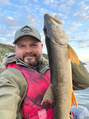
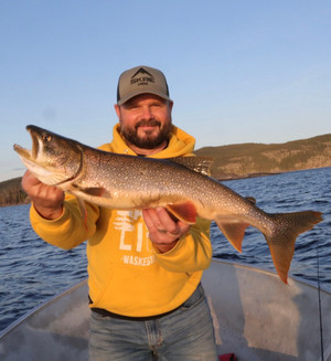
A huge number of different species of fish can be found in the lake including Arctic Grayling, Walleye, Lake Trout, Goldeye, Northern Pike, Cisco, Lake Whitefish, Round Whitefish, Burbot, White Sucker, Longnose Sucker and Yellow Perch. The largest lake trout ever recorded was caught in a gill net on the lake weighing over 102lbs!
There are quite a few different lodges operating on Lake Athabasca offering fly-in fishing adventures. It is a prime destination for trophy anglers looking for an incredible northern fishing experience.
Communities
Although Lake Athabasca is very remote, there are a number of communities on the lake including Fort Chipewyan and Fond du Lac. Uranium City is located just north of Lake Athabasca on Martin Lake
Lake Athabasca has an incredible number of tributaries including:
- Fond du Lac River
- Otherside River
- Helmer Creek
- MacFarlane River
- Archibald River
- William River
- Ennuyeuse Creek
- Dumville Creek
- Debussac Creek
- Jackfish Creek
- Claussen Creek
- Old Fort River
- Crown Creek
- Athabasca River
- Colin River
- Oldman River
- Bulyea River
- Grease River
- Robillard River
The lake is remnant of the Glacial Lake McConnell along with Great Bear Lake and Great Slave Lake.
Current Conditions
Weather
Quick weather at a glance. Tap for full details.
Satellite
Recent imagery around Lake Athabasca.
Nearby Water Stations
Quick links to nearby gauge stations and latest readings.
Details
| Fishing Zone: | Northern Zone |
| User Rating: | 5.0 / 5.0 |
| Favourited: | 1 times |
| Photos: | 35 photos of Lake Athabasca |
| Parks: | Athabasca Sand Dunes Provincial Park |
| Location: | 59.123901342692, -109.01873204606 |
| Shore Length: | 1,612km |
| Surface Area: | 1,925,762 acres |
| Max Width: | 50 km (31 mi) |
| Max Length: | 283 km (176 mi) |
| Max Depth: | 124 m (407 ft) |
| Inflows: | Peace River, which backs up through Rivière des Rochers during flooding, Athabasca River, William River, MacFarlane River, Colin River, Fond du Lac River, |
| Outflows: | Rivière des Rochers that meets with the Peace to form the Slave |
Comments, experiences, questions, and answers
Add CommentRating from
Comment from
Question from
Reply from
Directions to Lake Athabasca
Get directions to the lake: here
Note: this just takes you to the closest road to the centre of the lake, and may not be the best route to get to the lake.
For directions directly to a service/amenity at the lake click on one of the listings in Services & Amenities
Geomemorial Information
There are 9 features at Lake Athabasca named as part of the Geomemorial Naming Program.
Events
I don't know of any events at this time.
Athabasca Sand Dunes Provincial Park
Athabasca Sand Dunes Provincial Park is located at Lake Athabasca.
Website:
https://www.tourismsaskatchewan.com/provincialpark/1414/athabasca-sand-dunes-provincial-park
Fishing at Lake Athabasca
Lake Athabasca is in the northern fishing zone.
What fish are in Lake Athabasca
Learn all about fishing in Saskatchewan here.
Additional Restrictions:
Fishing Season
Fishing season on Lake Athabasca is from May 25, 2026 to April 15, 2027.
Fishing Limits for Lake Athabasca
| Species | Limit |
| Arctic Grayling | Limit 2 (only one may exceed 35 cm) |
| Goldeye | Limit 8 (combined limit for goldeye and mooneye) |
| Lake Trout | Limit 3 (only one may exceed 65 cm) |
| Northern Pike | Limit 5 (only one may exceed 75 cm) |
| Yellow Perch | Limit 25 |
| Walleye | Limit 4 (only one may exceed 55 cm, combined limit for Walleye/Sauger/Saugeye) |
| Lake Whitefish | Limit 8 (combined limit for all whitefish) |
| Burbot | Limit 8 |
| Cisco | Limit 8 (combined limit for all whitefish) |
| Round Whitefish | Limit 8 (combined limit for all whitefish) |
Disclaimer
Although we try our best to provide correct and updated information for every lake in Saskatchewan, all information on this site is provided to use at your own risk. Please reference the Saskatchewan Anglers Guide for more information.
Fishing Attractions/Services at Lake Athabasca
Boating at Lake Athabasca
I don't have any boat launches, or marinas reported for this lake. Let me know if I'm missing one!
Camping at Lake Athabasca
Beaches at Lake Athabasca
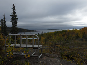
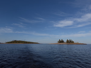
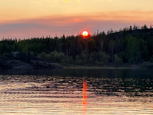
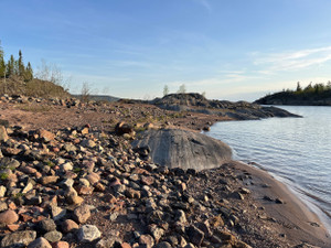
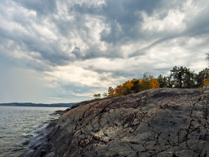
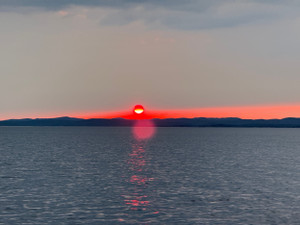
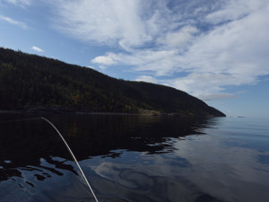
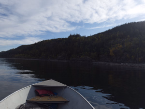
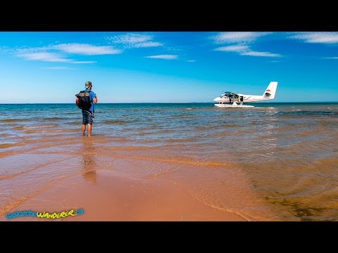
Photos of Lake Athabasca
Lake Athabasca
Lake Athabasca
Lake Athabasca
Lake Athabasca
Lake Athabasca
Lake Athabasca
Lake Athabasca
Lake Athabasca
Lake Athabasca
Lake Athabasca
Bathymetric Maps
Bathymetric (Depth) Charts for Lake Athabasca
Nearby Services & Amenities
Connected Rivers
Connected Rivers
Nearby Lakes


Products for Lake Athabasca
Resources
Resources
References
References
Other References
- Lake Athabasca (Wikipedia)
- Lake Athabasca (Canadian Geographical Names Database)
- Stewart Point (Canadian Geographical Names Database)
- https://athabascafishing.com/
- https://indianheadfishinglodge.ca/
- https://www.lakersunlimited.com/
- Exploring Saskatchewan’s Athabasca Sand Dunes
- Discovering the Land of the Giant Beaver, Athabasca Sand Dunes, Saskatchewan
- How to Visit the Athabasca Sand Dunes in Saskatchewan
- Lake Athabasca
Data Sources & References
- Weather data: OpenWeather - https://openweathermap.org/
- Satellite imagery: © European Union, Copernicus Programme (Sentinel data) - https://www.copernicus.eu/
View full details on your catch log.