Lac la Ronge

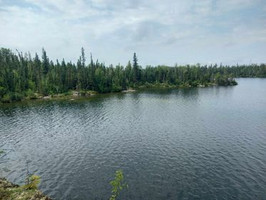
Lac la Ronge is a massive lake located 19km ENE of La Ronge in central Saskatchewan. Bigmouth Buffalo, Burbot, Cisco, Lake Trout, Longnose Sucker, Northern Pike, Perch, Walleye, White Sucker and Whitefish can be found in Lac la Ronge.

The lake has a surface area of 333,381 acres and is located at: 55.14041459394718, -104.88940893132511.

Lac La Ronge Provincial Park is located on Lac la Ronge.

Campground Trail

Things to do at Lac la Ronge

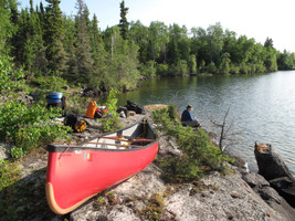
Lac la Ronge is a popular recreation destination with fishing, camping, hiking, and much more available!

See full list of activities

Fishing

Lac la Ronge is a popular fishing destination. Bigmouth Buffalo, Burbot, Cisco, Lake Trout, Longnose Sucker, Northern Pike, Perch, Walleye, White Sucker and Whitefish are found in the lake.

View fishing information

Camping

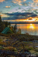
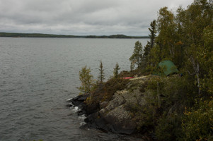
Camping is a popular activity at Lac la Ronge.

View campgrounds

Lake Updates

No recent updates.

Explore Lac la Ronge

Explore the amenities and activities available at Lac la Ronge.

About Lac la Ronge

The lake was officially named on 1953-04-02.

Bays on Lac la Ronge

There are 41 bays on Lac la Ronge.

  • Abrams Bay (Surface Area: 1850 acres)
  • Adamson Bay (Surface Area: 297 acres)
  • Arrowhead Bay (Surface Area: 446 acres)
  • Bear Bay (Surface Area: 67 acres)
  • Biology Bay (Surface Area: 44 acres)
  • Campbell Bay (Surface Area: 789 acres)
  • Chapman Bay (Surface Area: 103 acres)
  • Cochrane Bay (Surface Area: 338 acres)
  • Diefenbaker Bay (Surface Area: 1589 acres)
  • English Bay (Surface Area: 2782 acres)
  • Ewen Bay (Surface Area: 542 acres)
  • Four Portages Bay (Surface Area: 1191 acres)
  • Friedman Bay (Surface Area: 225 acres)
  • Hagarty Bay (Surface Area: 134 acres)
  • Hamilton Bay (Surface Area: 279 acres)
  • Hornet Bay (Surface Area: 858 acres)
  • Hunt Bay (Surface Area: 606 acres)
  • Hunter Bay (Surface Area: 34666 acres)
  • McGibbon Bay (Surface Area: 411 acres)
  • Meeyomoot Bay (Surface Area: 444 acres)
  • Mitchell Bay (Surface Area: 1445 acres)
  • Mooney Bay (Surface Area: 600 acres)
  • Murray Bay (Surface Area: 74 acres)
  • Nipekamew Bay (Surface Area: 884 acres)
  • Norm's Bay (Surface Area: 16 acres)
  • Nut Bay (Surface Area: 8380 acres)
  • Ore Bay (Surface Area: 1317 acres)
  • Pickerel Bay (Surface Area: 924 acres)
  • Pipestone Bay (Surface Area: 2452 acres)
  • Pothole Bay (Surface Area: 3027 acres)
  • Professor Bay (Surface Area: 117 acres)
  • Russell Bay (Surface Area: 684 acres)
  • Sauter Bay (Surface Area: 89 acres)
  • Sinclair Bay (Surface Area: 109 acres)
  • Staples Bay (Surface Area: 54 acres)
  • Suttill Bay (Surface Area: 488 acres)
  • Thomas Bay (Surface Area: 471 acres)
  • Toland Bay (Surface Area: 333 acres)
  • Vickar Bay (Surface Area: 46 acres)
  • Wadin Bay (Surface Area: 4737 acres)
  • Wilde Bay (Surface Area: 45 acres)

Islands on Lac la Ronge

There are 148 islands on Lac la Ronge.

  • Archer Island (Surface Area: 19 acres)
  • Aronson Island (Surface Area: 170 acres)
  • Arrowhead Island (Surface Area: 321 acres)
  • Ashfield Island (Surface Area: 89 acres)
  • Baby Gull Islands (Surface Area: 8 acres)
  • Bag Island (Surface Area: 2 acres)
  • Bay Island (Surface Area: 6 acres)
  • Bayard Islands (Surface Area: 87 acres)
  • Bear Island (Surface Area: 1640 acres)
  • Bereskin Island (Surface Area: 46 acres)
  • Big Island (Surface Area: 2420 acres)
  • Black Island (Surface Area: 343 acres)
  • Blanchard Island (Surface Area: 58 acres)
  • Blondeau Island (Surface Area: 190 acres)
  • Bonnycastle Island (Surface Area: 26 acres)
  • Boyd Island (Surface Area: 68 acres)
  • Braaten Island (Surface Area: 74 acres)
  • Bradshaw Island (Surface Area: 54 acres)
  • Brebber Island (Surface Area: 123 acres)
  • Brooks Island (Surface Area: 629 acres)
  • Bunn Island (Surface Area: 114 acres)
  • Burns Island (Surface Area: 45 acres)
  • Camp Island (Surface Area: 23 acres)
  • Centre Island (Surface Area: 27 acres)
  • Clarke Island (Surface Area: 296 acres)
  • Connell Island (Surface Area: 14 acres)
  • Cook Island (Surface Area: 54 acres)
  • Cowan Island (Surface Area: 797 acres)
  • Creighton Island (Surface Area: 539 acres)
  • Davis Island (Surface Area: 1 acres)
  • Doake Island (Surface Area: 16 acres)
  • Dodds Island (Surface Area: 425 acres)
  • Dog Island (Surface Area: 25 acres)
  • Dot Island (Surface Area: 3 acres)
  • Driscoll Island (Surface Area: 33 acres)
  • Edna Island (Surface Area: 7 acres)
  • Eliason Island (Surface Area: 1265 acres)
  • End Island (Surface Area: 12 acres)
  • Fairhead Island (Surface Area: 219 acres)
  • Feldman Island (Surface Area: 30 acres)
  • Fennell Island (Surface Area: 28 acres)
  • Five Islands (Surface Area: 4 acres)
  • Flatland Island (Surface Area: 133 acres)
  • Foster Island (Surface Area: 59 acres)
  • Fowler Island (Surface Area: 13 acres)
  • Fox Island (Surface Area: 22 acres)
  • Freeman Island (Surface Area: 1320 acres)
  • Fuller Island (Surface Area: 54 acres)
  • Giles Island (Surface Area: 24 acres)
  • Grey-Noble Island (Surface Area: 130 acres)
  • Halfburnt Island (Surface Area: 11 acres)
  • Harman Island (Surface Area: 584 acres)
  • Hayworth Island (Surface Area: 572 acres)
  • High Island (Surface Area: 29 acres)
  • Hillis Island (Surface Area: 481 acres)
  • Hindmarsh Island (Surface Area: 53 acres)
  • Hooge Island (Surface Area: 33 acres)
  • Hope Island (Surface Area: 288 acres)
  • Houghton Island (Surface Area: 65 acres)
  • Houseman Island (Surface Area: 17 acres)
  • Howard Island (Surface Area: 19 acres)
  • Howlett Island (Surface Area: 44 acres)
  • Hurl Island (Surface Area: 502 acres)
  • Jack Island (Surface Area: 4 acres)
  • Jackson Islands (Surface Area: 58 acres)
  • Jones Island (Surface Area: 714 acres)
  • Karcza Island (Surface Area: 100 acres)
  • Keller Island (Surface Area: 73 acres)
  • Kenderdine Island (Surface Area: 700 acres)
  • Kidd Island (Surface Area: 72 acres)
  • Kitsakie Island (Surface Area: 41 acres)
  • Kiyanaw Island (Surface Area: 12 acres)
  • Kubian Island (Surface Area: 179 acres)
  • Lab Island (Surface Area: 1 acres)
  • Lanceley Island (Surface Area: 728 acres)
  • Lefurgey Island (Surface Area: 299 acres)
  • Loehr Island (Surface Area: 33 acres)
  • Lone Tree Island
  • Long Island (Surface Area: 566 acres)
  • Love Island (Surface Area: 417 acres)
  • Lunch Island (Surface Area: 3 acres)
  • Lussier Island (Surface Area: 77 acres)
  • Macdonell Island (Surface Area: 22 acres)
  • MacNair Island (Surface Area: 307 acres)
  • Makwa Island (Surface Area: 10 acres)
  • Mallory Island (Surface Area: 123 acres)
  • Mandel Island (Surface Area: 310 acres)
  • Marg Island (Surface Area: 52 acres)
  • Marshall Island (Surface Area: 115 acres)
  • Martin Island (Surface Area: 66 acres)
  • McCannel Island (Surface Area: 87 acres)
  • McCulloch Island (Surface Area: 94 acres)
  • McKee Island (Surface Area: 114 acres)
  • McKenzie Island (Surface Area: 114 acres)
  • Mid Island (Surface Area: 1 acres)
  • Midge Islands (Surface Area: 35 acres)
  • Milliken Island (Surface Area: 250 acres)
  • Mollard Island (Surface Area: 206 acres)
  • Moore Island (Surface Area: 302 acres)
  • Moysey Island (Surface Area: 290 acres)
  • Mullen Islands (Surface Area: 125 acres)
  • Murphy Islands (Surface Area: 34 acres)
  • Murray Island (Surface Area: 249 acres)
  • Nelson Island (Surface Area: 314 acres)
  • Nut Island (Surface Area: 5 acres)
  • Orr Island (Surface Area: 106 acres)
  • Percy Island (Surface Area: 7 acres)
  • Peters Island (Surface Area: 302 acres)
  • Pike Island (Surface Area: 6 acres)
  • Pow Island (Surface Area: 294 acres)
  • Procter Island (Surface Area: 118 acres)
  • Quinlan Island (Surface Area: 233 acres)
  • Rainy Island (Surface Area: 1570 acres)
  • Reef Isle (Surface Area: 6 acres)
  • Rhind Island (Surface Area: 153 acres)
  • Rhoda Island (Surface Area: 18 acres)
  • Robertson Island (Surface Area: 48 acres)
  • Rowan Island (Surface Area: 14 acres)
  • Rowe Island (Surface Area: 110 acres)
  • Rubin Island (Surface Area: 865 acres)
  • Schellenberg Island (Surface Area: 30 acres)
  • Scott Island (Surface Area: 20 acres)
  • Seaker Island (Surface Area: 75 acres)
  • Shapiro Island (Surface Area: 9 acres)
  • Simpson Island (Surface Area: 37 acres)
  • Slant Island (Surface Area: 39 acres)
  • Soutar Island (Surface Area: 85 acres)
  • Spear Island (Surface Area: 37 acres)
  • Speirs Island (Surface Area: 133 acres)
  • Spot Island (Surface Area: 1 acres)
  • Staines Island (Surface Area: 270 acres)
  • Starfield Island (Surface Area: 323 acres)
  • Stueck Island (Surface Area: 47 acres)
  • Swanson Island (Surface Area: 53 acres)
  • Tait Island (Surface Area: 48 acres)
  • Tent Island (Surface Area: 1 acres)
  • Tingey Island (Surface Area: 233 acres)
  • Toland Island (Surface Area: 131 acres)
  • Trippe Island (Surface Area: 47 acres)
  • Two Islands (Surface Area: 4 acres)
  • Warburton Island (Surface Area: 52 acres)
  • Warne Island (Surface Area: 41 acres)
  • Weber Island (Surface Area: 26 acres)
  • Whitley Island (Surface Area: 486 acres)
  • Wilde Island (Surface Area: 16 acres)
  • Wolf Island (Surface Area: 106 acres)
  • Worden Island (Surface Area: 36 acres)
  • Zimmer Island (Surface Area: 48 acres)

How to get to Lac la Ronge

Get directions to locations on Lac la Ronge


Activities at Lac la Ronge

Fishing at Lac la Ronge

Lac la Ronge is in the central fishing zone.

Available Species

Bigmouth Buffalo, Burbot, Cisco, Lake Trout, Longnose Sucker, Northern Pike, Perch, Walleye, White Sucker and Whitefish can be found in Lac la Ronge. Learn all about fishing in Saskatchewan here.

Additional Restrictions:

Fishing Season

Fishing season on Lac la Ronge is open from May 15, 2023 to March 31, 2024.

Additional Restrictions:

Fishing Limits for Lac la Ronge

CR1 limits apply on Lac la Ronge.

These are the limits for all fish species reported to be in Lac la Ronge. All fishing limits for Saskatchewan.
Species Limit
Arctic Grayling 1
Lake Trout Limit 2
Northern Pike Limit 3
Walleye/Sauger/Saugeye Limit 2

Camping at Lac la Ronge

Camping is a popular activity at Lac la Ronge.

Hiking at Lac la Ronge


Attractions at Lac la Ronge

Lac La Ronge Provincial Park

Nut Point Campground

Campground

Phone: (306) 425-4234

Website: https://www.tourismsaskatchewan.com/listings/1444/nut-point-campground

Open May long weekend to Labour Day.

Located at: 55.1174003,-105.2481035

Get Directions

Wadin Bay Campground

Campground

Phone: 306-425-4220 1-800-772-4064

Website: https://www.tourismsaskatchewan.com/listings/1450/wadin-bay-campground

Open May long weekend to Labour Day.

Located at: 55.2853,-105.1666

Get Directions

Nut Point Trail

Trail

Located at: 55.12113,-105.23984

Get Directions


Depth Charts for Lac la Ronge


Details

Fishing Zone: Central Zone
Park: Lac La Ronge Provincial Park
Location: 55.14041459394718, -104.88940893132511
Shore Length: 772km
Surface Area: 333,381 acres
Max Depth: 42.1 m (138 ft)
Inflows: Montreal River, Bow River, Nemeiben River, Nipekamew River, Meeyomoot River
Outflows: Rapid River
Communities: La Ronge, Air Ronge, Lac La Ronge First Nation

Nearby lakes

Downton Lake 15.2km
Aikenhead Lakes 17.4km
Toland Bay Lake 18.4km
Bulbick Lake 19.2km
Cycloid Lake 19.3km

Get in touch

We'd love to hear from you! Let us know what you think about the site, what we should be adding or updating, or just say hi!

Data Disclaimer

Our data is sourced from a number of different online/offline sources. Errors/mistakes may exist, make sure to double check hours, locations, etc. Please use all data on this site at your own risk.