Steepbank Lake

Steepbank Lake is a small (370 acre) lake within Clarence-Steepbank Lakes Provincial Park.
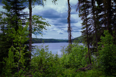
The lake is 54km NNE of Candle Lake (Village) and 123km NNE of Prince Albert. Steepbank Lake is within a steep valley and resembles a coastal fjord which is where the name came from.
The nearest highway to the lake is Highway 927. An access road runs past many of the lakes in the provincial park but ends before it gets to Steepbank Lake. Along the access road, there is a bridge that is no longer maintained, although you can walk across it, it is unsafe for vehicles. From the bridge, you can walk into Steepbank Lake itself.
There is a sandy beach and two primitive campsites at the lake. This is a very pretty lake and well worth the effort to get too.
Details
| Fishing Zone: | Central Zone |
| User Rating: | 5.0 / 5.0 |
| Favourited: | 2 times |
| Photos: | 9 photos of Steepbank Lake |
| Parks: | Clarence - Steepbank Lakes Provincial Park |
| Location: | 54.267700059048266, -105.10954828426257 |
| Shore Length: | 11km |
| Surface Area: | 370 acres |
| Max Depth: | 29.6 m (97 ft) |
| Outflows: | Bow River |
Comments, experiences, questions, and answers
Add CommentRating from
Comment from
Question from
Reply from
Directions to Steepbank Lake
Events
I don't know of any events at this time.
Map
Explore Steepbank Lake with our interactive map.
Clarence - Steepbank Lakes Provincial Park

Fishing at Steepbank Lake
Steepbank Lake is in the central fishing zone.
What fish are in Steepbank Lake
Lake Trout, Northern Pike, Yellow Perch, Walleye and White Sucker can be found in Steepbank Lake.Learn all about fishing in Saskatchewan here.
Additional Restrictions:
Fishing Season
Fishing season on Steepbank Lake is from May 15, 2025 to March 31, 2026.
Fishing Limits for Steepbank Lake
| Species | Limit |
| Lake Trout | Limit 3 (only one may exceed 65 cm) |
| Northern Pike | Limit 5 (only one may exceed 75 cm) |
| Yellow Perch | Limit 25 |
| Walleye | Limit 4 (only one may exceed 55 cm, combined limit for Walleye/Sauger/Saugeye) |
Disclaimer
Although we try our best to provide correct and updated information for every lake in Saskatchewan, all information on this site is provided to use at your own risk. Please reference the Saskatchewan Anglers Guide for more information.
Boating at Steepbank Lake
I don't have any boat launches, or marinas reported for this lake. Let me know if I'm missing one!
Camping at Steepbank Lake
There is 1 campground at Steepbank Lake.
Beaches at Steepbank Lake
There is 1 beach at Steepbank Lake.
Nearby Lakes


Photos
Add Photos


About the photo
Intersection on the road out to Steepbank. The lake is down the left hand path.


Bathymetric (Depth) Charts for Steepbank Lake
Old Provincial Bathy Charts
These maps were produced by the government a long time ago, using primitive methods. They are not intended for navigation and should not be expected to be accurate.
View full details on your catch log.