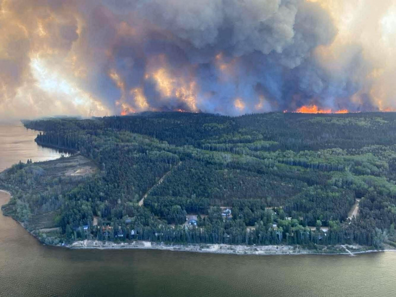
SHOE Fire
Last updated: 7 hours ago
Started May 7, 2025 – 386,145 hectares burned
Not Contained
Disclaimer: The information on this page is provided for general awareness and
convenience only. It is not real-time, may be incomplete or outdated,
and should not be used for emergency decision-making.
Fire locations, perimeters, and activity data are sourced from public datasets, satellite imagery, and
user contributions, which may have delays or inaccuracies. For the most up-to-date and official wildfire
information, consult your local fire authority or provincial wildfire agency.
I'm building these fire pages out right now, so check back for more info/features in the next
few days. - Matt
Description
This fire is still burning uncontrolled in Narrow Hills Provincial Park and the surrounding area. It has resulted in damage at East Trout Lake, Piprell Lake, the Gem Lakes, Baldy Lake, Upper Fishing Lake, Lower Fishing Lake and many other lakes and is threatening Candle Lake, Whiteswan Lake, and Little Bear Lake.
Multiple evacuations have been caused by this fire.
Nearby
These distances are based on approximate fire boundaries that are only updated a few times a day. They
will NOT be current and should not be relied on.
They are useful for general awareness of the fire's location relative to other places only.
They are useful for general awareness of the fire's location relative to other places only.
- Little Bear Lake Recreation Site - 0.00 km away
- East Trout-Nipekamew Lakes Recreation Site - 0.00 km away
- Whiteswan Lake (Whelan Bay) Recreation Site - 2.40 km away
- Torch River - 9.93 km away
- Choiceland - 10.24 km away
- Snowden - 10.32 km away
- Smeaton - 11.37 km away
- Garrick - 11.62 km away
- Resort Village of Candle Lake - 12.60 km away
- Minowukaw Beach - 14.15 km away
Timeline of Fire
- Fire started: May 7, 2025
- May 23, 2025: 18,408 hectares
- May 24, 2025: 27,681 hectares
- May 26, 2025: 47,274 hectares
- May 29, 2025: 283,298 hectares
- May 30, 2025: 308,257 hectares
- May 31, 2025: 322,681 hectares
- June 1, 2025: 384,949 hectares
- June 2, 2025: 386,145 hectares
Map of Fire
Photos